A Guide to the Stari Grad Plain
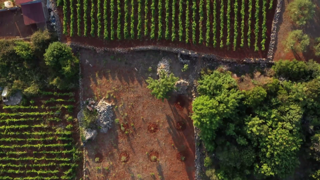
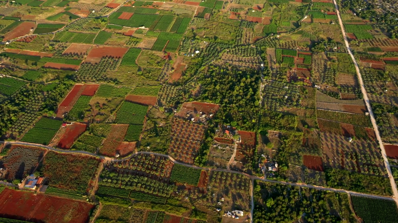
The Starigrad Plain is an extended area of fertile land divided into neat farming plots. Situated in the heart of Hvar Island, its 1376 hectares make it the biggest single area of fertile land on the island, indeed on all of Croatia’s Adriatic islands. It holds, hidden within itself, a large amount of Hvar’s history. It is also the best-preserved example of ancient cadastral field plot divisions in the Mediterranean, and was inscribed in UNESCO’S World Heritage List as a cultural landscape in 2008.
It is as important to the island’s inhabitants now as it was 2400 years ago. With some 120 archaeological sites, it has the added kudos of being labelled one of the most significant archaeological locations in Croatia. This island heritage landscape is living testimony to the labour and suffering of Hvar’s peasants over millennia, at the same time as being the source of food for the island and the wider Dalmatian region. Seen through the eyes of scientists, historians or wine-producers, it is fascinating and unique in its exceptional character and identity. The wine-producer will focus on the vines which launched the beginnings of wine production on Hvar Island; the historian will concentrate on the intact field parcelization, where the shadowy outlines of the ancient Greeks materialize out of the morning mist, those people who carefully and patiently built up the limestone walls edging the field along the paths. The autochthonous island spices and intoxicating scents which emanate from the Starigrad fields are irresistible attractions for every biologist. In addition, the peace and serenity of the rural tracks will carry every sports enthusiast back to the ancient lifestyle which was marked by daily exercising and the sight of outstanding athletes in the streets of the polis.
As you read this article, try to keep in mind the number of people who have lived in this place over the centuries, leaving their beads of sweat and their labours on the land as they tended carefully to this little piece of heaven on earth, to pass it on to the next generations so that it would remain as it is today, exquisite in its simplicity and in linking people to the earth. Generations of ancient Greeks, Romans, Illyrians and finally Slavs succeeded each other alternately. All of them had the same, almost identical reasons for preserving the land and culture and passing down from generation to generation communal self-sustainability through cultivating the autochthonous plants and grape varieties which still grow on this land as the sole witnesses to the uninterrupted historical passage of time on the island.
A walk across the Starigrad Plain is a kind of return to the past, so let’s set out at a relaxed pace…
The Geography of the Plain
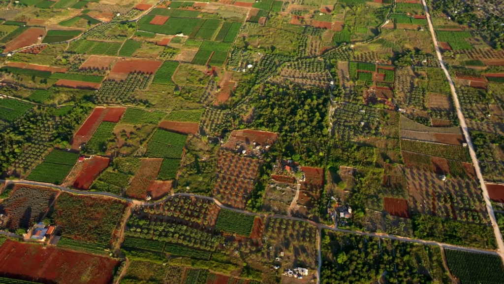
The Starigrad Plain is situated towards the western part of Hvar Island, where the island is at its widest (10 km). The Plain is about 6 km long by 2 km wide. It is bordered by Stari Grad town to the west, and the charming settlements of Vrboska and Jelsa to the east. To the south are the picturesque Hvar villages Dol, Vrbanj, Svirče, Vrisnik and Pitve, while to the north-west, rather isolated, is the village of Rudine. The northern edges of the Plain reach almost to the coast, facing the Island of Brač.
Come with us on an unforgettable adventure across this beautiful locality and breathe in the aromas of the island’s ancient life.
The Beginning: How The Plain Came To Be
Way back, about 24 centuries ago, Greek colonists decided to create the foundations for a new settlement in the fertile island plain which they called the ‘Hora Faru’. These Ancient Greeks set out the basic layout of the fields on the Plain, which is recognizable to this day. Having chosen the central starting point, called the omphalos, they created the right-angled land plots according to the ancient system of dividing up land. The plots have dry stone wall boundaries, and are divided by a series of main pathways. This parcelization enabled the Greeks to make full use of the fertile Plain’s potential, and they planted not only vines and olives, which are the main crops today, but also wheat, which is no longer grown. The edges of the Plain, where the soil was poorer, was used for sweet figs.
The first mention of the Starigrad Plain is recorded in the 1331 Hvar Statute, where there is a detailed description of the Plain’s limits, its old tracks and walls.
In the course of time, the name of the Plain changed: when the Romans came to dominate the region, it was called the ‘Ager’, a name which many local people prefer to use today. In the Middle Ages it was called ‘ Campus Sancti Stephani’ (‘St. Stephen’s Field’). At that time, according to the Hvar Statute, the Slavs who owned the land made the land plots smaller, and several little chapels and shrines were built around the Plain. It was at about this time that the Processions linked to the mysteries of Good Friday and Christ’s Resurrection came to the fore. These Processions have been carried out almost continuously up to the present day, and include the best-known, UNESCO-listed ‘Za Križen‘ (‘Following the Cross’).
Archaeological Sites
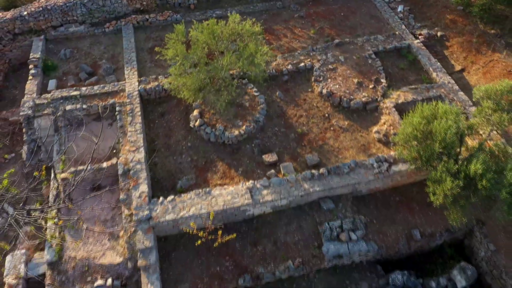
There are about 120 known archaeological sites across the Plain, making it one of the most important archaeological locations in Croatia.
These are six wonderful locations preserved on the Starigrad Plain, which you can visit at any time:
• Maslinovik was an Ancient Greek fort situated in the northern part of the Starigrad Plain. Its humble but interesting remnants can still be seen at the top of a mound, 67 m above sea level, north of the Plain’s airstrip. It seems it was similar in size and shape to the Tor above Jelsa, although a couple of stone blocks are all that remains of it. Archaeological research there uncovered ceramics dating from the 4th century BCE. The Maslinovik Fort was most probably a watchtower, of which there were several all along the island. The soldiers in the fortified building would have communicated with the other watchtowers and the settlements by means of smoke signals, when potential danger, particularly from the sea, was spotted.
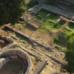
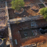
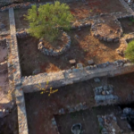
• The ‘Ager Pharensis’. When the Romans came, the Plain began to change slowly. The field plots came into the ownership of rich landowners. There is a reminder of the Roman hedonistic approach to life in the remnants of luxurious country villas (‘villae rusticae’) which were once part of wealthy properties. An example of such a villa is to be found in the Kupinovik locality, an area named after the abundant blackberry bushes which grew there, north of the village of Dol. The Kupinovik villa dates back to the 1st century CE,and is a rectangular shape surrounded by stone mounds. Archaeological digs on the site have revealed two olive presses, mills, cisterns for water or oil as well as the foundations of various rooms. Also uncovered were black and white mosaic tiles and coins from the times of the emperors Domitian, Trajan and Marcus Aurelius.
• Further east, near the settlement of Vrboska, we come across yet another historical treasure in the shape of an Ancient Roman ‘villa rustica’ in the historical locality called Mirje.
• The next stop is Dračevica which nestles unobtrusively by the northern edge of the Plain, and contains a natural pond, which only dries up in exceptionally hot weather.
• The ‘Omphalos‘, the central point from which the Plain parcelization was measured out, is the place which gives the widest view over the whole extent of the Starigrad Plain. With the help of a ‘groma‘ (an ancient surveying tool, in use from the 6th century BCE), every 180m stage on the main north-south axis was marked out, and every five 900m stages on the east-west axis. Precise measurements have proved that the Starigrad Plain was laid out according to this method, and the two axes crossed at the central Omphalos.
• The Katovnica Botanical Garden. Coming across this unusual botanical garden on your walk around the Starigrad Plain will probably be a big surprise. It is situated to the north of the old Dol-Vrbanj road in the area called Katovnica. It is redolent with the intoxicating scents of lavender, sage and aromatic rosemary. The garden has been designed and planted by Matko Roić, an elementary school teacher in Stari Grad, now retired. In it there are autochthonous Mediterranean plants, some of them cultivated traditionally (such as lavender and olives) and self-seeding, wild plants such as Spanish broom, pyrethrum, sage, honeysuckle, thyme, lemon balm, myrtle, wild pistachio trees, strawberry trees, rosemary, heather and many others. The names of the plants are written, charmingly, on stone plaques, giving the Latin title, the standard Croatian name and the local dialect version. The Botanical Garden also contains a beautifully laid out stone representation of Hvar Island, with a touching tribute by Cvite Škarpa, a renovated stone roundhouse (locally known as a ‘trim‘), a collection of Hvar’s different types of stone and soil, and a small meteorological station.
A UNESCO SITE INTERLINKED WITH UNESCO INTANGIBLE HERITAGE TRADITIONS
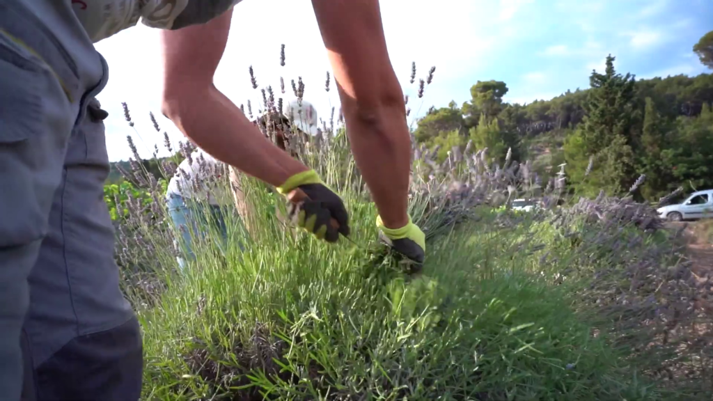
In modern times the Starigrad Plain has adapted to a certain extent to the needs of its new inhabitants. One modern addition is the little airstrip, which serves as a base for tourist sightseeing flights, aerial sports like parachuting, as well as for medical emergency use. Alongside the centuries-old olive groves and vineyards there are a few carob plantations and aromatic lavender fields. Dotted around the Plain are the little stone roundhouses (‘trimovi‘), some very old, some more recent, all constructed according to the same dry stone principles to create shelter in times of bad weather for the field workers and their animals.
In 2018, ‘The art of dry stone walling, knowledge and techniques‘ was inscribed on the UNESCO Representative List of the Intangible Cultural Heritage of Humanity. The dry stone walls separating the field plots on the Starigrad Plain are a perfect example of the value of these specialized building techniques, having served their purpose in harmony with the landscape from the 4th century BCE up to the present day.
In 2009, ‘Za Križen‘ (‘Following the Cross‘), a tradition specific to Hvar Island was also inscribed on the UNESCO Representative List of the Intangible Cultural Heritage of Humanity. The Maundy Thursday all-night people’s Processions between the six settlements of Jelsa, Pitve, Vrisnik, Svirče, Vrbanj and Vrboska has been taking place annually for some 500 years. Some of the circular route passes through the Starigrad Plain, so that the Plain – uniquely – can boast of being not only a UNESCO heritage site in itself, but also host to two Intangible Heritage traditions.
The Starigrad Plain is significant for many reasons. As one of the most important cultural-historical sites on Hvar, it is inscribed in the Croatian Register of Cultural Assets.
Some of the reasons for its importance:
• It is a well-preserved example, showing the spread of the Greek system of geometrical land plot divisions around the Mediterranean from the 4th century BCE.
• It has been under cultivation continuously through the centuries, with some crops (notably vines and olives) consistent over 2400 years.
• However, this old tradition of land use is now under threat because of modern economic developments, especially through population loss from the island’s settlements, and the abandonment of traditional methods of agriculture.
Appreciate the experience to the full
We hope this explanation of the history and importance of the Starigrad Plain will help you to enjoy exploring this unique landscape. Please respect the environment – and if you come across any unwelcome sights such as illegal rubbish dumps, please report the details and the exact location to the Tourist Board Office.
For professional guidance and information about the Starigrad Plain, please contact the Management Agency, Agencija za upravljanje Starogradskim poljem. (The website is in Croatian only, but English is spoken)
